
A new primary with nursery, a bus corridor to Bat and Ball, a one-way Rye Lane and a floodplain park: what the council's brief promises on 1,500 homes.
Comments closed at 11.59pm on Thursday 17 September, with 2,175 responses published. Land north of Sevenoaks, the 1,500-home site ST4-7, stays in the plan the council will submit to the Government later this year; an inspector examines it in 2027. Otford Parish Council has asked for this allocation to be deleted outright.
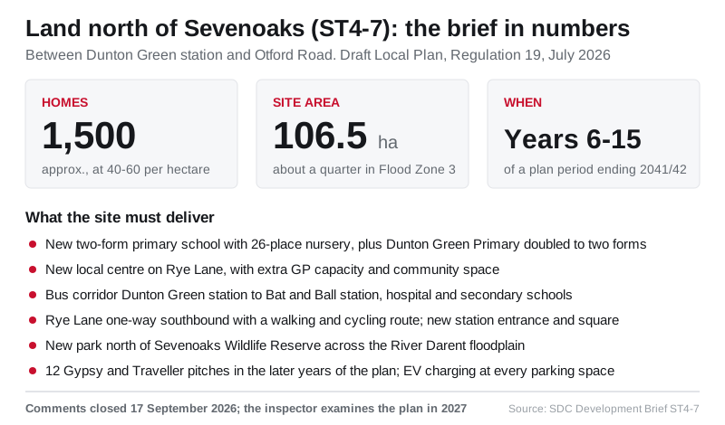
The largest housing site in the district’s draft Local Plan, around 1,500 homes on 106.5 hectares of farmland between Dunton Green station and Otford Road, would bring a new two-form-entry primary school with a 26-place nursery, the doubling of the existing Dunton Green Primary School, a new local centre on Rye Lane, a bus corridor linking Dunton Green and Bat and Ball stations, and a public park across the River Darent floodplain, according to the council’s development brief for the land, which Otford Parish Council republished on Sunday alongside recordings of its recent public meetings. Comments on the plan closed on 17 September. (Sevenoaks District Council, Development Brief, ST4-7 (SEV24) Land north of Sevenoaks, Regulation 19, July 2026 (PDF); Otford Parish Council, Regulation 19 Public Information Events Presentations and Links, 16 August 2026)
The site, reference ST4-7 in Policy ST4 of the Regulation 19 plan, is by some distance the biggest single allocation in the Sevenoaks urban area: the policy’s seven Sevenoaks sites total 2,148 homes, and this one accounts for 1,500 of them. The plan describes it as “a well-contained grey belt site on the edge of the District’s principal town, outside the National Landscape, with good access to local amenities and public transport”, bounded by the M26 to the north, Otford Road to the east, the railway and Dunton Green station to the west and Sevenoaks Wildlife Reserve to the south, with Rye Lane and the River Darent running through it. (Sevenoaks District Council, Sevenoaks District Local Plan, Regulation 19 Publication version, paragraph 4.35 and Policy ST4 (PDF))
What the brief commits a developer to
Development briefs are the council’s site-by-site rulebook. The document says any future planning application “will be expected to demonstrate accordance with the development brief”, and that where a proposal departs from it the applicant “must provide a clear and robust justification”. For the land north of Sevenoaks the brief sets a proposed use of “mixed-use, residential, primary school, community”, a net density of 40 to 60 homes per hectare, a capacity of “approx. 1500 residential units, a primary school and mixed uses”, and a delivery timeframe of “years 6-10, 11-15” of the plan period. The plan period runs for 15 years to 2041/42, so the earliest homes would be expected in the early 2030s. (Sevenoaks District Council, Development Brief, ST4-7 Land north of Sevenoaks (PDF); Sevenoaks District Council, Local Plan Regulation 19 Housing Trajectory, July 2026 (PDF))
The site-specific infrastructure list is the part residents of Dunton Green, Riverhead and Otford will want to read closely. It requires:
- A “new 2FE primary school with 26 place nursery”, positioned next to the new local centre on Rye Lane, with “a strong frontage to the meadow open space” and “a forest-school character”, and the “expansion of Dunton Green Primary School from 1FE to 2FE”, that is, from one form of entry to two.
- A new or improved bus service linking Dunton Green station, the school and the local centre to Bat and Ball station, Sevenoaks Hospital and the local secondary schools. The brief says the bus corridor should run from Otford Road through the site “enabling the circular 8 service to be extended into Sevenoaks”.
- Dunton Green station improvements: formalising the path to the station with better walking and cycling provision, lighting and CCTV, and new waiting shelters, plus “a new direct accessible pedestrian and cycle entrance to Dunton Green Station” inside the site with an “eastern green station square”.
- Walking and cycling improvements aligned with route 8 of the Sevenoaks Local Cycling and Walking Infrastructure Plan, open space, children’s play space and sports provision under the plan’s policies. (Sevenoaks District Council, Development Brief, ST4-7 Land north of Sevenoaks (PDF))
The brief’s list of “placemaking deliverables” repeats the “new local centre, provision of new primary school and expansion of Dunton Green Primary School” and adds “a new park to the north of the Sevenoaks Wildlife Reserve”, “improved pedestrian and cycle connections to London Road” and “a high percentage of affordable homes”. Under community needs it says the scheme should “include a new primary school, additional GP capacity, and flexible community/creative spaces”. (Sevenoaks District Council, Development Brief, ST4-7 Land north of Sevenoaks (PDF))
One caution for anyone reading the copy circulated by Otford Parish Council: it is not quite the same document. The version linked from the parish website, dated 8 July in its file properties, lists the school requirement as the “relocation of Dunton Green Primary School and expansion from 1FE to 2FE”, and refers throughout to “the relocated and expanded primary school”. The version on the district council’s own downloads page, dated 21 July, instead requires a new two-form-entry school with a 26-place nursery on the site plus the expansion of Dunton Green Primary; the rest of the two documents is the same. We have used the district council’s version here, and residents responding to the consultation should do the same. (Sevenoaks District Council, Development Brief, ST4-7 Land north of Sevenoaks, council downloads page (PDF); Otford Parish Council copy of the same brief (PDF))
Rye Lane goes one-way, Otford Road gets a frontage
Two road changes stand out. The brief says Rye Lane, currently “a narrow rural lane with passing bays”, “must retain its rural character as a hedgerow-lined lane with woodland views”, and that “vehicular use must be restricted to a one-way southbound street, with a high-quality pedestrian and cycle route alongside”. Otford Road, by contrast, “will form a more urban frontage with active ground floors and enhanced cycle lanes”, with “a new north-south cycle link along Otford Road” and improved crossings “along London Road and Otford Road (including the Sainsbury’s junction)”. The brief also floats restructuring the Aldi car park “to create safe, overlooked pedestrian routes”, and says the existing underpasses beneath the M26 “should be upgraded and future-proofed for walking and cycling”. (Sevenoaks District Council, Development Brief, ST4-7 Land north of Sevenoaks (PDF))
The homes themselves would be arranged “in hamlets that respond to their setting: higher densities closer to Dunton Green and Bat & Ball stations, stepping down towards the reserve, floodplain, and countryside edges”. Density would range from 30 to 40 homes per hectare at the green edges and around the listed Rye Cottage to 50 to 60 near landmark buildings and the station. Every parking space, public or private, “must provide EV charging facilities”. (Sevenoaks District Council, Development Brief, ST4-7 Land north of Sevenoaks (PDF))
The constraints the council itself lists
The plan is candid about the difficulties. It says “approximately a quarter of the site is subject to Flood Zone Three and minerals safeguarding and it is adjacent to an SSSI (Sevenoaks Wildlife Reserve/Gravel Pits)”. The brief adds that the M26 and railway “generate noise and visual impacts, requiring mitigation through structural planting”, that “significant level changes from Otford Road constrain site access”, that London Road, the A25 and Otford Road “currently offer poor pedestrian crossings and limited walking/cycling facilities, despite serving multiple schools and a hospital”, and that “fragmented land ownership will necessitate a coordinated approach to secure a coherent and phased masterplan”. (Sevenoaks District Council, Sevenoaks District Local Plan, Regulation 19 Publication version, paragraph 4.35 (PDF); Sevenoaks District Council, Development Brief, ST4-7 Land north of Sevenoaks (PDF))
The River Darent floodplain is to become what the brief calls the “Central Meadow Green”, “a naturalistic sequence of meadows, wetlands, and SuDS features that provide habitat, flood resilience, and public amenity”. Development must stay out of a 15-metre buffer around ancient woodland, respect the garden setting of Rye Cottage, a listed former farmstead whose surroundings the brief identifies as “a heritage constraint”, and be preceded by an archaeological assessment because the land “has archaeological potential from prehistoric, medieval, through to 19th century remains”. Cooperation with Kent Wildlife Trust, which runs the reserve, “will be required”, and any application must assess the cumulative impact on the SSSI of surrounding development, which the brief notes includes Sevenoaks Quarry to the east “with outline consent for around 900 homes and a leisure lake”. (Sevenoaks District Council, Development Brief, ST4-7 Land north of Sevenoaks (PDF))
One further use is set out elsewhere in the plan: the site is one of two strategic sites of more than 1,000 homes proposed to accommodate Gypsy and Traveller pitches “in the later years of the Plan period”, with 12 pitches on the land north of Sevenoaks and 12 at Pedham Place. (Sevenoaks District Council, Sevenoaks District Local Plan, Regulation 19 Publication version, Chapter 2 (PDF))
What Otford has been told
Otford Parish Council held four information events on 13 and 15 July and 4 and 5 August at which its own councillor Carol Bent and clerk Irene Bowie set out the parish’s analysis, and district councillor Irene Roy presented on behalf of Sevenoaks District Council. On Sunday the parish council published video of both presentations, together with links to this brief and to the briefs for the two allocations inside the parish, land west of Hale Lane (13.34 hectares) and Ryecroft (0.22 hectares, seven to 13 homes), and launched its own resident survey to run alongside the district’s. It urges villagers to “complete both surveys before the consultation closes on the 17th September”, adding “your voice counts twice”. (Otford Parish Council, Regulation 19 Public Information Events Presentations and Links, 16 August 2026; Sevenoaks District Council, Development Brief, ST2-30 (OT1) Ryecroft (PDF))
The Hale Lane site, allocated for around 203 homes, was the issue on which a Save Otford’s Green Belt slate swept all three seats at July’s parish by-election; we reported that in Otford by-election: green belt slate sweeps all three seats.
What it means for you, now the consultation has closed
An allocation is not a planning permission. If the plan is found sound by a Government inspector and adopted, it establishes the principle of around 1,500 homes on this land and the list of things a developer must provide; the layout, the exact number of homes, the phasing and the detail of the school, bus route and park would all be settled through a planning application, or more likely a series of them given the divided ownership, on which residents can comment separately. Nothing in the brief obliges a landowner to bring the site forward at all, which is why the plan phases it into years six to 15.
The window for saying any of that to the council has closed. Comments had to be received “no later than 11.59pm on Thursday 17 September 2026”, and the council’s consultation portal has since published 2,175 responses, each readable in full. What the inspector now weighs is whether the plan is “sound” and legally compliant, the tests set out in the council’s guide to responding, and only those who asked on the response form can speak at the 2027 hearings. This brief and all the others stay online on the council’s Regulation 19 downloads page, which matters because it is the document a developer will be held to. (Sevenoaks District Council, Statement of Representations Procedure, July 2026 (PDF); Sevenoaks District Council, Local Plan proposals)
For the other allocations on the town’s edge, see Brittains Lane 284 homes: now for the Local Plan inspector. To follow any application that eventually comes forward, our guide to Sevenoaks planning applications explains how to search and track the council’s portal, and for the stations at either end of the proposed bus corridor see Sevenoaks train times to London.
Sources
- Sevenoaks District Council, Development Brief, ST4-7 (SEV24) Land north of Sevenoaks, Regulation 19, July 2026 (PDF)
- Sevenoaks District Council, Sevenoaks District Local Plan, Regulation 19 Publication version, July 2026 (PDF)
- Sevenoaks District Council, Local Plan Regulation 19 Housing Trajectory, July 2026 (PDF)
- Sevenoaks District Council, Development Briefs, Regulation 19, summer 2026 (downloads page)
- Sevenoaks District Council, Development Brief, ST2-30 (OT1) Ryecroft, Regulation 19, July 2026 (PDF)
- Sevenoaks District Council, Statement of Representations Procedure, July 2026 (PDF) (withdrawn from sevenoaks.gov.uk when the consultation closed on 17 September 2026)
- Otford Parish Council, Regulation 19 Public Information Events Presentations and Links, 16 August 2026
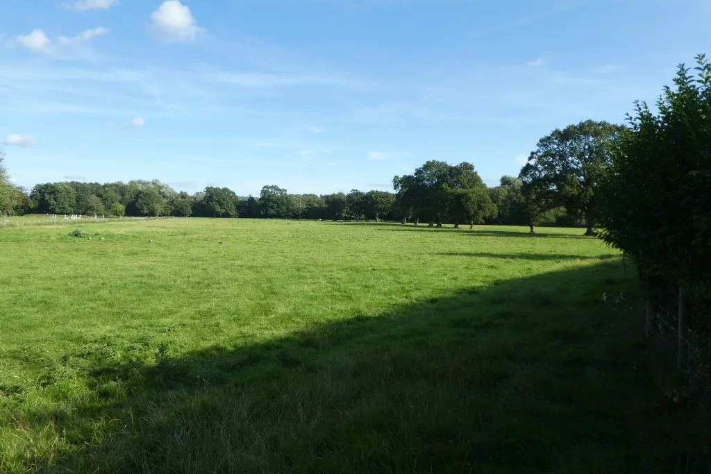
Image: Field near Rye Lane by DS Pugh, CC BY-SA 2.0, via Geograph.
Have your say