
Otford Parish Council's formal objection calls two allocations unsound and asks for their removal, after 93% of 613 surveyed residents opposed both sites.
Otford Parish Council has asked Sevenoaks District Council to remove the district’s two biggest Otford-area housing allocations from the draft Local Plan, calling them “fundamentally unsound, unjustified, and inconsistent with national planning policy”. Its formal objection was published on Thursday, the day the Regulation 19 consultation closed. (Otford Parish Council, Regulation 19 Submission and Resident Planning Survey Analysis)
The two sites it wants deleted are:
- ST4-7, land north of Sevenoaks west of Otford Road: around 1,500 homes between Dunton Green station and Otford Road, the second largest allocation in the plan
- ST4-24, Lavender Fields, land west of Hale Lane: around 203 homes on the western edge of Otford
The parish council also objects to the smaller ST2-30 allocation at Ryecroft, off Ryecroft Road. It wants the 10 homes proposed there reduced, and all vehicle access taken from Ryecroft Road with none from Rye Lane. (Otford Parish Council, Regulation 19 representation)
What 613 residents said
The submission is backed by the parish council’s own survey, run in July and hand-delivered to every household in the village. It drew 613 responses. (Otford Parish Council, Resident Planning Survey Analysis Report)
The findings are stark:
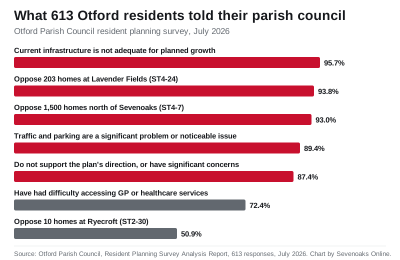
- 93.8 per cent opposed the Lavender Fields allocation, with 75.2 per cent strongly opposed
- 93.0 per cent opposed the 1,500 homes at ST4-7
- 95.7 per cent of those who answered said current infrastructure is not adequate for the planned growth
- 87.4 per cent either did not support the plan’s direction or had significant concerns; 2 per cent broadly supported it
- 89.4 per cent called traffic and parking a significant problem or noticeable issue
- 72.4 per cent had experienced difficulty getting GP or healthcare appointments
Opposition to the small Ryecroft site was softer: 50.9 per cent opposed it, while a third were neutral.
The survey was self-selecting, distributed through the parish newsletter, Facebook and door-to-door delivery, and the analysis report says respondents spanned all adult age groups and lengths of residency. One resident’s comment, quoted in the report, sums up the mood: “Once our Green Belt is built on, it is gone forever.”
The council’s own evidence, turned against it
The legal heart of the representation is that the district council’s site choices contradict its own Green Belt Assessment. That assessment, the parish council says, identifies both ST4-24 and ST4-7 as making a strong contribution to Green Belt purposes, yet the plan releases them as “grey belt” without explaining why those findings were outweighed. (Otford Parish Council, Regulation 19 representation)
It raises three specific evidence gaps:
- the assessment only covers the southern part of the Lavender Fields site, so part of the allocation has no published Green Belt evidence at all
- no cumulative assessment was made of releasing both sites, which together would leave the gap between Sevenoaks, Dunton Green and Otford depending on the M26 and the railway rather than open countryside
- the council’s own Jacobs transport study rates the Otford cluster red, the lowest category, meaning “car dependent” with “low potential for modal shift”, with around 70 per cent of trips still by car after mitigation
On transport, the representation notes Otford has no regular bus service. The S2, the only bus serving the Lavender Fields site, runs once a day and does not stop at Otford station.
Water that is already running out
The submission puts unusual weight on water supply, and it arrives with fresh first-hand evidence. It records that water tanker lorries were stationed at the top of Tudor Drive from Friday 11 to Sunday 13 September, supplying around 130 homes below the Pilgrims Way East junction, and that St Michael’s School closed on the Friday because it had no water supply. (Otford Parish Council, Regulation 19 representation)
The parish council had published South East Water’s update on those supply problems a few days earlier. Its representation argues that a network already needing tankers for existing customers cannot be assumed to cope with thousands of new homes, and that over-abstraction from the River Darent, a chalk stream that has previously run dry in sections, must be given significant weight at examination.
What it means for you
The Regulation 19 consultation closed at 11.59pm on Thursday 17 September, as we set out in our final-week guide to the plan. The district council must now submit the plan, with every representation including Otford’s, to the Secretary of State for independent examination by a planning inspector. The inspector, not the parish council, will decide whether the allocations are sound.
The survey found 58.7 per cent of respondents intended to send their own representation to the district council, so Otford’s voice at examination is likely to be far larger than one submission.
The ST4-7 site is the same land covered by the council’s development brief for around 1,500 homes, which we examined in detail here, and which Kent Wildlife Trust has opposed over its Sevenoaks reserve. Every planning application that eventually follows the plan can be tracked through our guide to checking Sevenoaks planning applications.
Sources
- Otford Parish Council, Regulation 19 Submission and Resident Planning Survey Analysis, 17 September 2026
- Otford Parish Council, Resident Planning Survey Analysis Report, July 2026 survey, 613 responses (PDF)
- Otford Parish Council, Representations on Sevenoaks District Council Regulation 19 Consultation (Word document)
- Otford Parish Council, Recent Update from South East Water, 11 September 2026
- Sevenoaks District Council, Regulation 19 consultation page
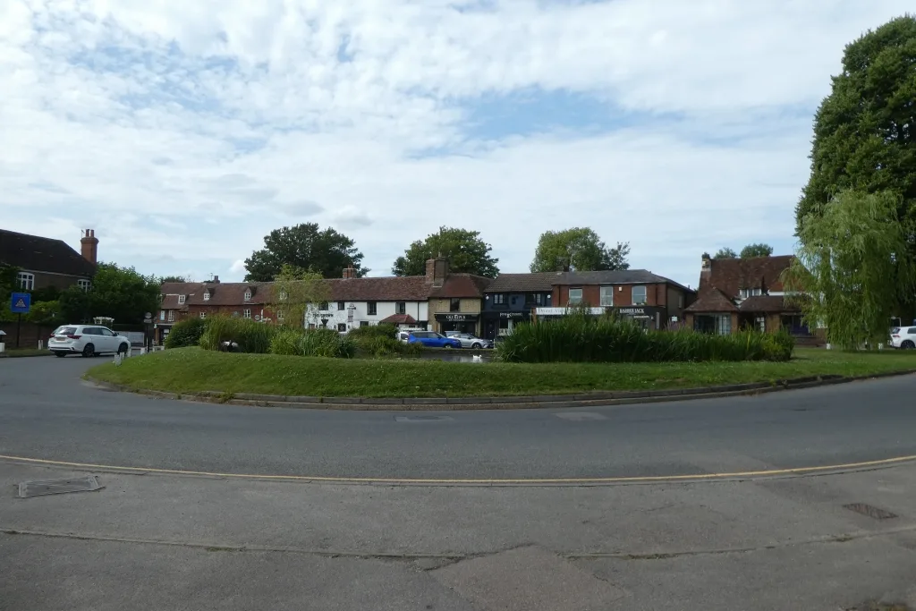
Image: Otford roundabout and village pond by DS Pugh, CC BY-SA 2.0, via Geograph.
Have your say