
The council refused a new farm access onto Ashgrove Road in February for want of evidence the land is farmed. The appeal started on 27 May and is undecided.
A plan for a new farm access with fencing and a gate onto Ashgrove Road in Sevenoaks is now with the Planning Inspectorate, after Sevenoaks District Council refused it in February on the grounds that it had not been given enough evidence the land is actually farmed. The appeal was lodged on 18 May and formally started on 27 May, and is still undecided. (Sevenoaks District Council, Appeal 26/00026/RFPAPD, Public Access)
The site is a field known as Land South of Larches, on the west side of Ashgrove Road in the Sevenoaks Kippington ward. It sits inside both the Metropolitan Green Belt and the Kent Downs National Landscape. (Sevenoaks District Council, Application report 26/00053/AGRNOT, 3 February 2026)
It is the second time the council has turned down essentially the same proposal. An inspector last examined the use of this land in 2006, and that decision runs through everything the council and the objectors have said since.
What was applied for, and why it was refused
The application, reference 26/00053/AGRNOT, was registered on 12 January 2026 by Mr James Cullen, through Genesis Town Planning of Chichester. It asked the council to confirm whether prior approval was needed for a new gated agricultural access under Schedule 2, Part 6, Class B of the General Permitted Development Order, the route that lets some farm works go ahead without a full planning application. (Sevenoaks District Council, Decision notice 26/00053/AGRNOT, 9 February 2026)
The council refused it on 9 February, for one reason:
“There is considered insufficient information to determine the agricultural use of the site. The new access is not considered to satisfy the requirement of being ‘reasonably necessary for the purposes of agriculture within the unit’ and the proposal does not comply with Schedule 2, Part 6, Class B of the Town and Country Planning (General Permitted Development) (England) Order 2015 (as amended).”
(Sevenoaks District Council, Decision notice 26/00053/AGRNOT, 9 February 2026)
The point turns on a definition rather than on the look of a gate. Class B rights apply to agricultural land, and the Order defines that as land in use for agriculture “for the purposes of a trade or business”. Case officer Christopher Park wrote that the applicant had supplied a Single Business Identifier number, but that this “is not conclusive in the absence of more substantive evidence”, and that no information had been given on how often the land is grazed or at what scale.
He also set out what he found on the ground: “Having looked at historic aerial photography, there is no evidence of livestock being kept on the land for extended periods and, during a site visit, I neither observed any livestock or other agricultural activities within the site, nor did I observe any evidence of previous activities.” His report accepts that sheep grazing is agricultural in nature, but concludes there is “insufficient evidence provided for me to accept an agricultural use of the site within the parameters defined”. (Sevenoaks District Council, Application report 26/00053/AGRNOT, 3 February 2026)
The applicant’s case, as summarised in the officer report, was that the field already has an access, but that it crosses third party land the applicant does not control, so a controlled and independent access is wanted. The officer described that desire as understandable, but said the ambiguities about the extent, timing and nature of the farming remained. (Sevenoaks District Council, Application report 26/00053/AGRNOT, 3 February 2026)
The 2006 decision that keeps coming up
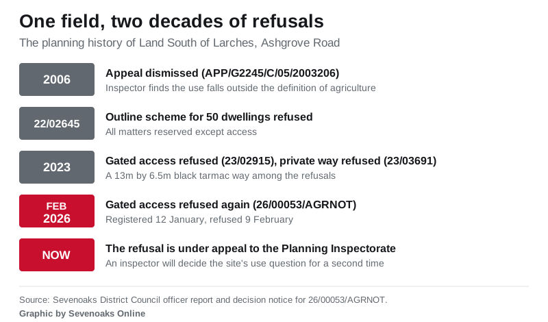
The officer report cites an appeal decision on the same land from 2006, reference APP/G2245/C/05/2003206, in which an inspector questioned the agricultural use of the site, said the land did not appear to be used for the purposes of trade or business and had occasionally been grazed alongside other land in different ownership, and concluded that the use fell outside the definition of agriculture.
That 2006 inspector also found that forming a formal access would harm the appearance of the National Landscape through the loss of the verge and the addition of hardstanding and an entrance gate. Mr Park wrote that even if the works had been shown to be reasonably necessary for farming, he would share that view. (Sevenoaks District Council, Application report 26/00053/AGRNOT, 3 February 2026)
The report lists three earlier refusals as relevant planning history for the site: an outline application for 50 dwellings with all matters reserved except access, refused under 22/02645/OUT; a gated access refused under 23/02915/AGRNOT in 2023; and a new private way 13 metres long by 6.5 metres wide in black tarmac, refused under 23/03691/LDCPR. (Sevenoaks District Council, Application report 26/00053/AGRNOT, 3 February 2026)
Who is objecting
Three sets of objections were before the council when it refused the application in February. The Sevenoaks Society told the council the proposal was “virtually identical” to the one refused in 2023 and that the applicants “have not put forward any further information or evidence relating to the agricultural use of the area in question”. It argued the site is not agricultural land for permitted development purposes because no evidence had been presented that it is used for a trade or business, and that “there is nothing to show that the present means of access cannot continue to be used for the future”. (Sevenoaks District Council, Application report 26/00053/AGRNOT, 3 February 2026)
The Ashgrove Residents Association pointed to the findings of the previous officer and the previous inspector, and said the site does not form part of a farm business or trade run by the applicant. One neighbour wrote in to say there were no problems using the existing access, that sheep were put on the land and taken off again shortly afterwards, and that the field had been empty since August. (Sevenoaks District Council, Application report 26/00053/AGRNOT, 3 February 2026)
Mr Park was careful about how much weight he put on those objections, writing that while he could not wholly rely on them, they aligned with his own observations. (Sevenoaks District Council, Application report 26/00053/AGRNOT, 3 February 2026)
The town council has written to the inspector
Sevenoaks Town Council took the appeal at its Planning and Environment Committee on 15 June, after the Ashgrove Area Residents Association asked members for support. The draft minutes, published in the committee’s 29 June agenda pack, record that councillors resolved to write to the planning inspector opposing the appeal on four grounds: that the existing access is adequate for the agricultural use currently taking place on the land; that the agricultural justification does not satisfy the “reasonably necessary” test under Class B; that the 2006 inspector’s decision remains material to the current proposal; and that the planning history does not support creating a new access onto Ashgrove Road. (Sevenoaks Town Council, Planning and Environment Committee agenda, 29 June 2026, including draft minutes of 15 June 2026 (PDF))
The town council is a consultee rather than the decision maker. The deadline for its representation was 1 July. (Sevenoaks Town Council, Planning and Environment Committee agenda, 29 June 2026 (PDF))
What happens next
The appeal carries the council reference 26/00026/RFPAPD and the Planning Inspectorate reference 6009872, and is being handled by written representations, which means no hearing and no public inquiry: an inspector reads the papers, visits the site and issues a decision. The council’s record shows the appeal at “in progress”, with no inspectorate decision date. (Sevenoaks District Council, Appeal 26/00026/RFPAPD, Public Access)
If the appeal is dismissed, the position stays where the February decision notice left it: the applicant would need to submit a full planning application to pursue the scheme without changing it, which is what the council’s refusal notice told them. If it is allowed, the works go back onto the permitted development route rather than needing a full application, though the officer report notes that because the council refused on the agricultural question it never went on to test the proposal against the other conditions in Class B. (Sevenoaks District Council, Decision notice 26/00053/AGRNOT, 9 February 2026, and Application report, 3 February 2026)
What it means for you
Nineteen documents sit on the appeal file and twelve on the original application, including the refusal notice, the full officer report, the location plan, the proposed gate elevation and every public comment. All of them are free to read on the council’s Public Access portal, and the appeal record links straight through to the application it came from. Search by reference at pa.sevenoaks.gov.uk using 26/00053/AGRNOT for the application or 26/00026/RFPAPD for the appeal.
The wider point for anyone who follows planning locally is what a Class B application is and is not. It is not a planning application, and the council is not weighing whether an access would look right or add traffic. It is a narrower question of whether the land qualifies as an agricultural unit and whether the works are reasonably necessary for farming it. That is why the argument here is about grazing records and business evidence rather than about hedges and sightlines. Our guide to Sevenoaks planning applications explains how to search the portal for your own street, how long you get to comment and what the different reference codes mean.
Sources
- Sevenoaks District Council, Appeal 26/00026/RFPAPD, Land South of Larches, Ashgrove Road, Public Access
- Sevenoaks District Council, Application 26/00053/AGRNOT documents, including the decision notice of 9 February 2026 and the officer report of 3 February 2026
- Sevenoaks Town Council, Planning and Environment Committee agenda, 29 June 2026, including the draft minutes of the meeting of 15 June 2026 (PDF)
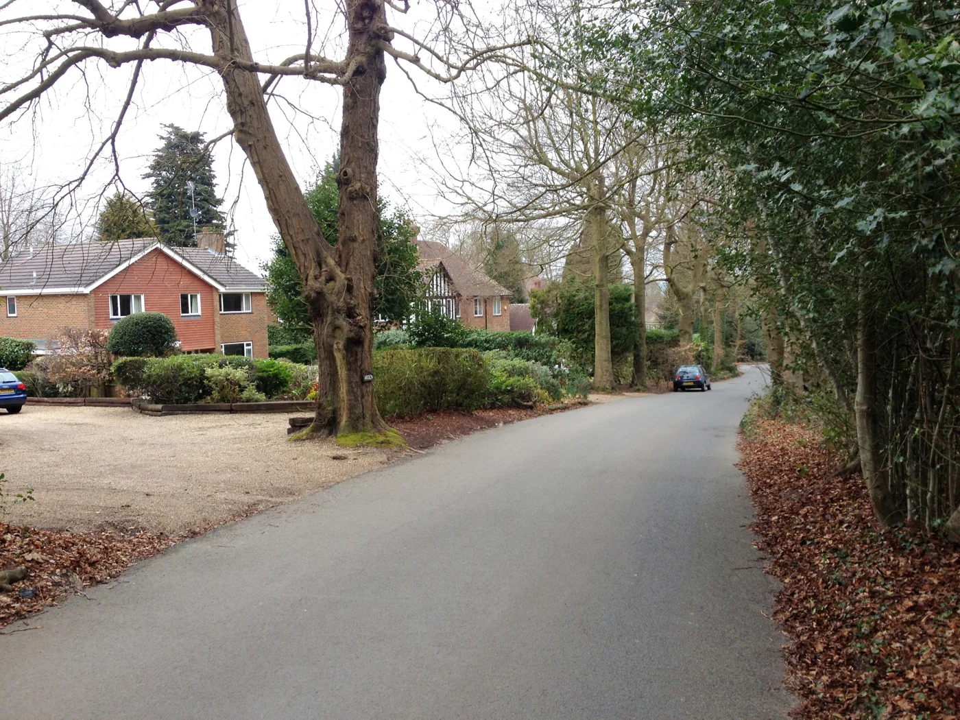
Image: Ashgrove Road, Sevenoaks by Chris Whippet, CC BY-SA 2.0, via Geograph. The photo shows the road, not the appeal site.
Have your say